Geology
March 30, 2023
New Colorado 30×60 minute quadrangle datasets
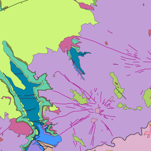
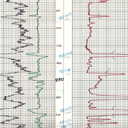
Underwritten with special supplemental funding though the US Geological Survey (USGS) STATEMAP Program, we digitized, re-compiled, and quality-controlled several…
The <a href=”https://en.wikipedia.org/wiki/United_States_Geological_Survey” rel=”noopener” target=”_blank”>United States Geological Survey</a> is a bureau of the United States Department of the Interior; it is that department’s sole scientific agency. The CGS often collaborates with USGS scientists, most importantly in the generation of geologic quadrangle maps around the state.
Geology
March 30, 2023
Underwritten with special supplemental funding though the US Geological Survey (USGS) STATEMAP Program, we digitized, re-compiled, and quality-controlled several…
admin
March 1, 2023
The 2023 Association of American State Geologists meeting—hosted by the Colorado Geological Survey—takes place in Glenwood…
Geology
August 16, 2022
The origins of The Great ShakeOut project lie, unsurprisingly, in Southern California, one of the more…
Geology
March 15, 2022
OF-20-11 Alkaline Complexes of the Wet Mountains Area, Colorado: A Geological Summary, Bibliography, and Data Compilation…
Geology
June 3, 2021
For those of you who are subscribers to the CGS announcement list, we want to direct your attention to a…
Geology
April 26, 2021
The CGS actively participates in the STATEMAP portion of…
Geology
September 9, 2020
The CGS actively participates in the STATEMAP portion of…
Hazards
March 13, 2013
This video, from the U.S. Geological Survey, explores the geological factors behind sinkholes and the related science. Narrated by Randall…