
Geology
June 5, 2024
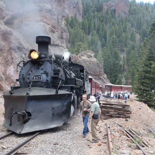
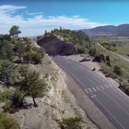
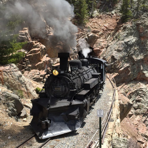
Cumbres & Toltec Geology Train – June 9th, 2024
Many of you know and love the Geology Train – the Colorado Geological Survey’s twice-annual partnership with the Cumbres &…
Geology
June 5, 2024
Many of you know and love the Geology Train – the Colorado Geological Survey’s twice-annual partnership with the Cumbres &…
Geology
November 30, 2023
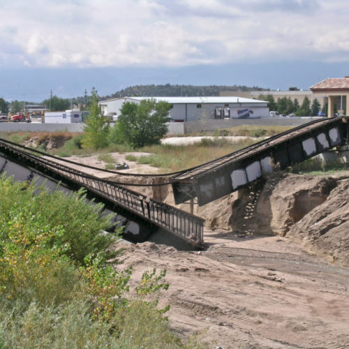
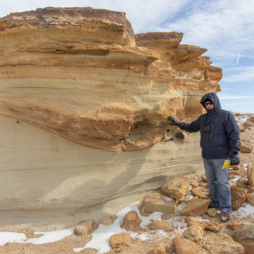
Following up on last year’s popular geological photo tour around the state, we’re proud to share this next collection from…
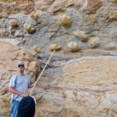
Geology
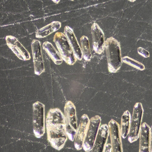
November 21, 2023
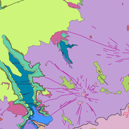
[ED: On the occasion of releasing a new dataset: ON-004-04D Data tables of detrital zircon U-Pb…
Geology
August 9, 2023
This year’s September 10th Geology Train — a very special and popular opportunity to enjoy…
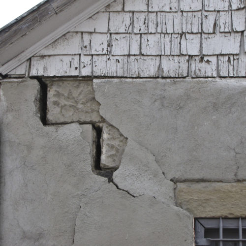
Hazards
August 7, 2023
Although the US wildfire season this year doesn’t seem quite as intense as prior ones, we thought this excellent primer…
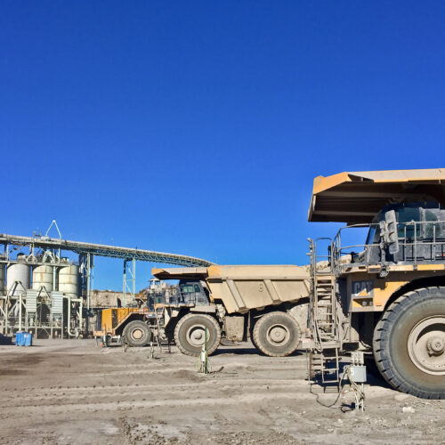
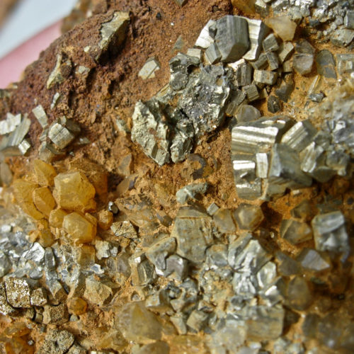
Minerals
April 13, 2023
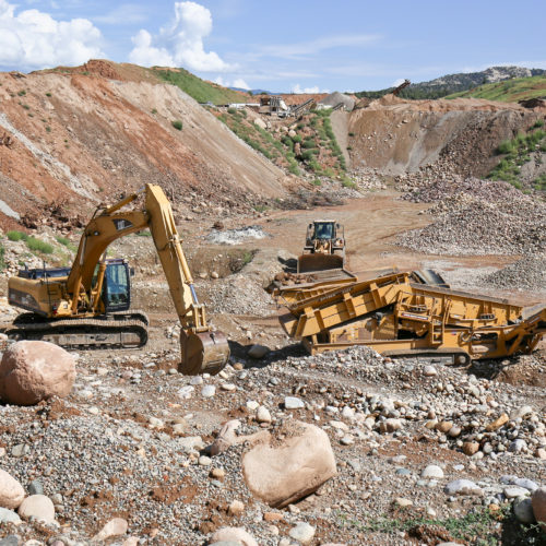
The current annual Colorado Mineral and Energy Industry Activities report for 2021-22 is now available. Following up on…
Geology
March 30, 2023
Underwritten with special supplemental funding though the US Geological Survey (USGS) STATEMAP Program, we digitized, re-compiled, and quality-controlled several…
admin
March 1, 2023
The 2023 Association of American State Geologists meeting—hosted by the Colorado Geological Survey—takes place in Glenwood…
Water
February 7, 2023
“Water is the lifeblood of our state, and we are taking strong actions to protect Colorado’s water for generations to…
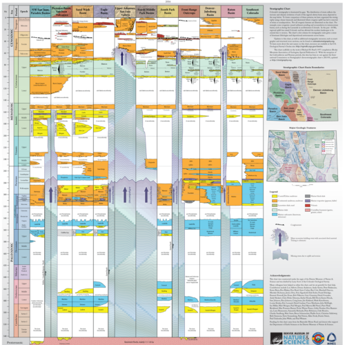
Geology
December 16, 2022
We’ve been wanting to put together a calendar for some time now, and 2023 seems to be the right…
Water
November 11, 2022
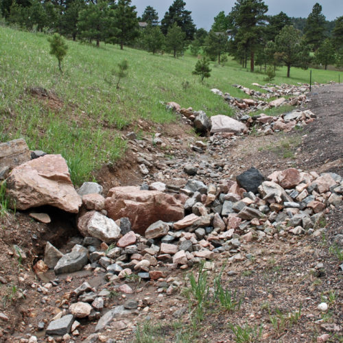
“The Fluvial Hazard Zone (FHZ) is defined as the area a stream has occupied in recent history, may occupy, or…
Hazards
September 23, 2022
It’s coming up in less than four weeks! The Great Colorado ShakeOut is a public earthquake drill that takes place…
admin
September 12, 2022
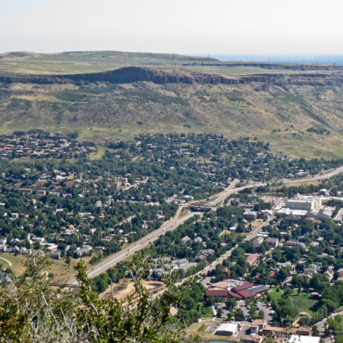
Matt Morgan, Colorado Geological Survey, Director and Colorado State Geologist, Red Rocks Park, Morrison,…
Geology
September 7, 2022
A collaboration between the CGS and the Denver Museum of Nature & Science (DMNS) has…
Geology
August 16, 2022
The origins of The Great ShakeOut project lie, unsurprisingly, in Southern California, one of the more…
General
July 27, 2022
Dr. Christian Shorey—Teaching Professor of Environmental Science and Climatology in the Geology and Geological Engineering Department…
Hazards
July 21, 2022
Are pristine mountain waters always clean and pure? Can streams unaffected by human activities and livestock influences be unfit…
Geology
May 19, 2022
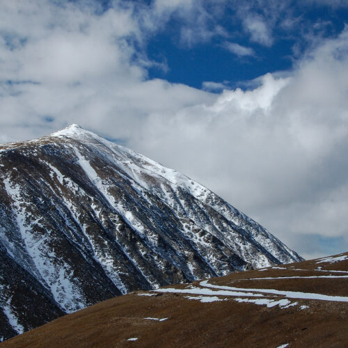
Fremont County, two hours south of Denver, is located on the south-central Front Range of Colorado in a geological region…
Geology
May 10, 2022
We’ve received the go ahead to help distribute this marvelous (and FREE!) 100+ page digital publication from the talented…
Geology
April 21, 2022
Our collaborators and friends up in Boulder at the Geological Society of America (GSA) are making…
Geology
April 11, 2022
Small but significant areas of Colorado are underlain by bedrock that is composed of evaporative…
Geology
April 8, 2022
One of our favorite online feeds is from the NASA Earth Observatory along with their…
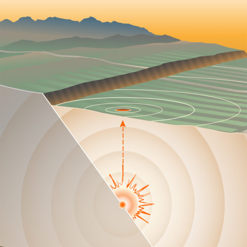
Hazards
March 25, 2022
Early History The Colorado School of Mines first acquired and installed a single three-component seismograph in the…
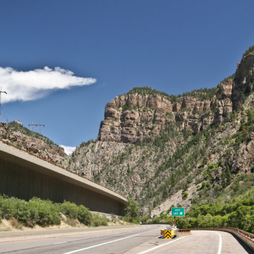
Geology
March 16, 2022
This recent RMPBS/Colorado Experience video traces the history of transportation through Colorado’s spectacular Glenwood Canyon. It…
Geology
March 15, 2022
OF-20-11 Alkaline Complexes of the Wet Mountains Area, Colorado: A Geological Summary, Bibliography, and Data Compilation…
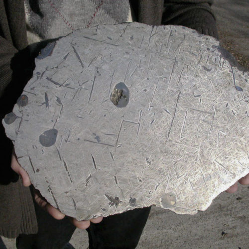
General
March 9, 2022
By Matthew Morgan, Deputy Director, Colorado Geological Survey and Gary Curtiss, Lakewood geologist and meteorite collector A…
General
February 21, 2022
We just found out about this year’s Cumbres & Toltec Geology Train adventures in southwest Colorado and northwest New Mexico.
Minerals
February 3, 2022
Every year, the CGS Minerals section prepares a comprehensive survey of the mineral and energy industries across the state. The…
Water
January 14, 2022
Stormwater runoff is excess water associated with a rain or snow storm event that flows over the…
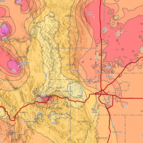
Energy
November 19, 2021
The CGS has long been involved in researching the characteristics of geothermal energy across the state,…