Description
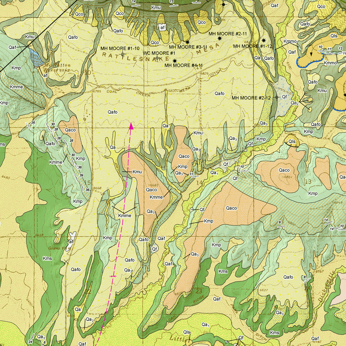
The purpose of this map is to describe the geology of this 7.5-minute quadrangle located in the vicinity of the town of Meeker in northwestern Colorado. CGS staff geologist Jonathan L. White and field assistants James Hodge and Michael J. Zawaski completed the field work on this project at the end of the summer of 2010. Jon White, the principal mapper and author, created this report using field maps, photographs, structural measurements, and field notes generated by all the investigators. Significant knowledge was also gained by a compilation of the available published geologic literature listed in the references. This map was improved from reviews by Larry Moyer (consulting petroleum geologist), David Noe (Colorado Geological Survey), as well as pertinent edits of the adjacent Meeker quadrangle by Rex Cole (Colorado Mesa University). This mapping project was funded jointly by the U.S. Geological Survey (USGS) and the CGS. USGS funding comes from the STATEMAP component of the National Cooperative Geologic Mapping Program, award number G10AC00410, authorized by the National Geologic Mapping Act of 1997, reauthorized in 2009. CGS matching funding comes from the Colorado Department of Natural Resources Severance Tax Operational Funds, from severance taxes paid on the production of natural gas, oil, coal, and metals in Colorado. Digital ZIP download. OF-13-06D
From the Author’s Notes:
The Rattlesnake Mesa 7.5-minute quadrangle is located in Rio Blanco County, Colorado, along the valley of the White River. The Town of Meeker lies to the west, just off the map along State Highway 13. Meeker is the county seat of Rio Blanco County. The most striking features in the quadrangle are the Meeker Dome, the Mesaverde escarpment and high ridges along the northern third of the quadrangle, and several secondary streams valley floors that debouche to the White River valley in the southern portion of the map in Agency Park. The highest elevation (8,568 feet) is on a ridge above the escarpment in the north-central portion of the quadrangle. The lowest elevation (6,270 feet) occurs on the floor of the White River valley where the river exits along the southwestern corner of the quadrangle.
