Description
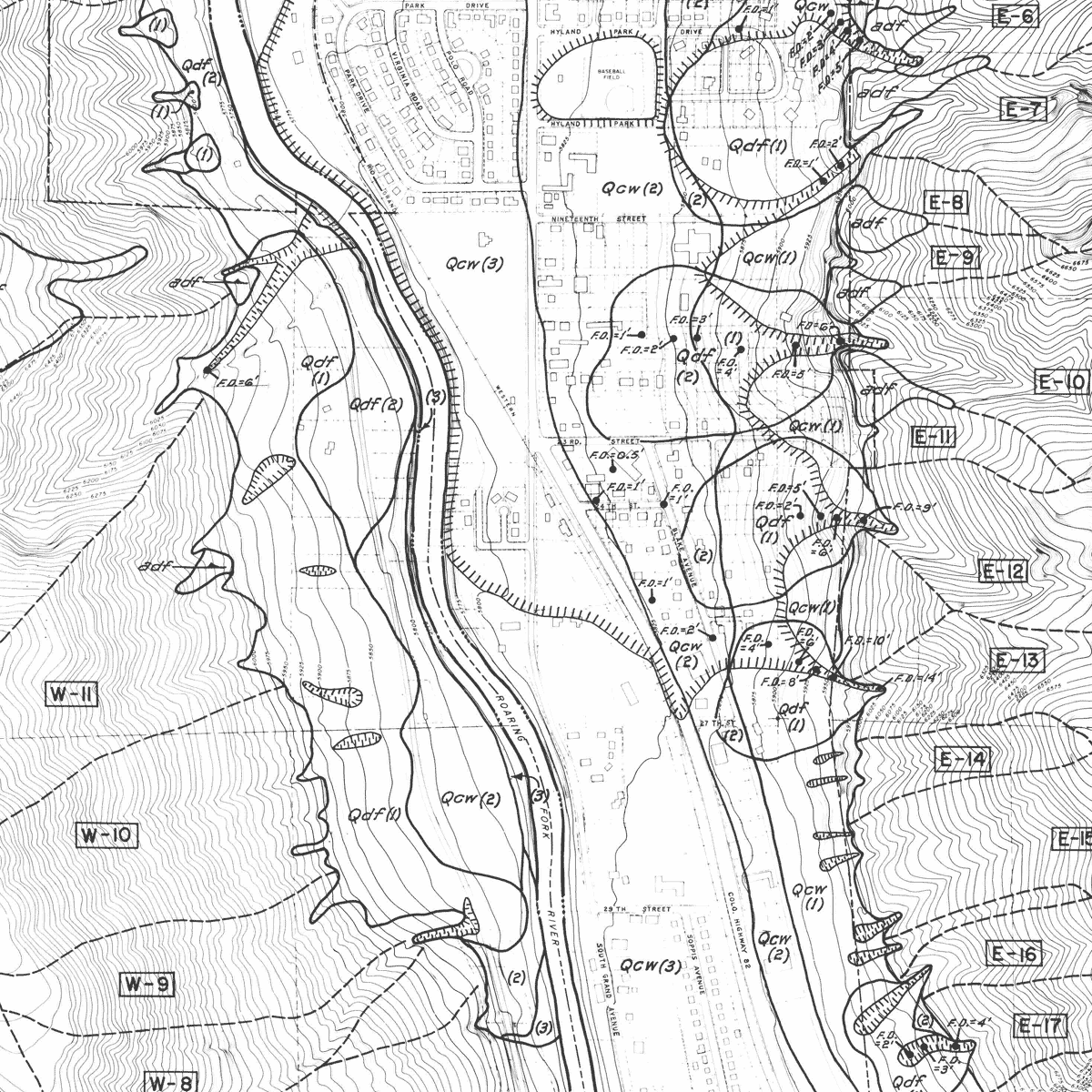
Fourteen plates and text about geologic hazards of the Glenwood Springs Metropolitan Area, Garfield County. Plate 1 provides project boundary and sheet index; Plates 2-5, surficial geology and data index maps; Plates 6 – 9, debris fan deposits and hazards in portions of Glenwood Springs; Plates 10 – 14, general geologic hazard maps. Includes comparative stream profile sheets. Text describes general geology, debris-flow hazards, and hydrocompaction. 27 pages. 3 figures. 14 plates (1:24,000). Digital PDF download. OF-78-10D
Glenwood Springs, county seat of Garfield County, Colorado, lies at the junction of the Roaring Fork and Colorado Rivers near the west-central edge of the Southern Rocky Mountains. Surrounded on the north, east, and south by high, steep mountains, the city occupies a narrow canyon at an elevation of about 5800 feet and possesses a mild, semi-arid climate. Due to its setting of abrupt topography and complex geology, both the city and its surroundings are subject to a variety of geologic processes that in the presence of human settlement constitute natural hazards.
On the evening of July 24, 1977, a major thunderstorm swept enormous quantities of mud, rock, tree limbs, and other debris into a city residential district. In less than a half hour, about 200 acres of the city was covered to depths ranging between four inches and 14 feet. This event led to a recognition of the local importance of such debris flows, together with ground subsidence, mass wasting, and other processes, to the inhabitants of the area. As a result, Colorado Geological Survey, in cooperation with the planning departments of the City of Glenwood Springs and Garfield County, co-funded a study of the nature, extent, and severity of geologic hazards active within the study area. The results of that study are summarized in this report.
