General
May 15, 2017
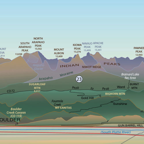
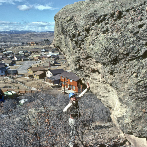
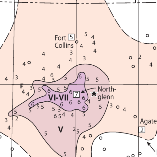
OF-16-03 Colorado Rocky Mountain Front Profiles
(NOTE: We’ are currently rolling over our physical publications sales to Amazon, and we haven’t yet gotten this great poster…
General
May 15, 2017
(NOTE: We’ are currently rolling over our physical publications sales to Amazon, and we haven’t yet gotten this great poster…
General
May 13, 2017
We’ve decided to revive one of our most popular print publications — RockTalk — as a blog so that…
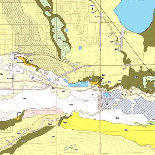
Geology
April 12, 2017
We just uploaded the most recent of our STATEMAP mapping products to…
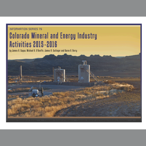
Publications
February 17, 2017
The current annual Colorado Mineral and Energy Industry Activities report 2015-16 is now available. Following up on the…
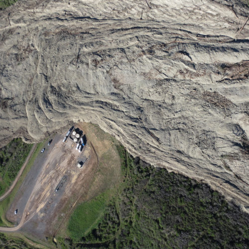
Hazards
January 23, 2017
On May 25, 2014 the longest landslide in Colorado’s historical record occurred in west-central Colorado, six miles (10 km) southeast of the small…
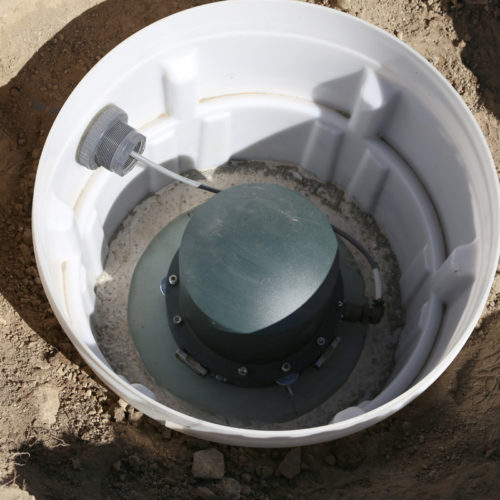
Hazards
September 3, 2016
The CGS recently installed the first of five new seismic recording stations that will collect information on seismic events…
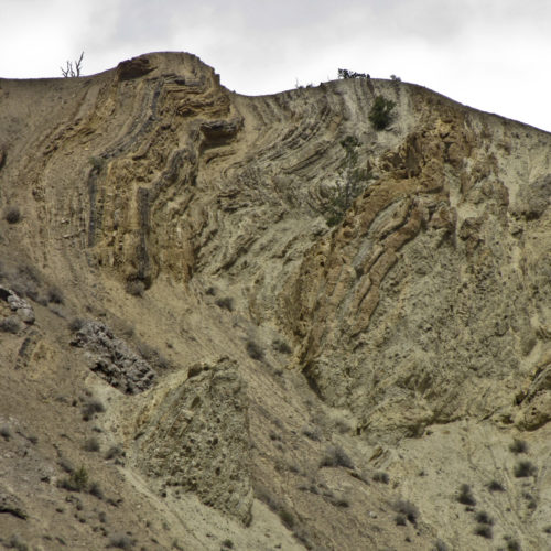
Hazards
May 5, 2015
[ED: Originally written by Jonathan White, Senior Engineering Geologist (emeritus staff) for a 2001 volume of…
Hazards
March 4, 2015
Deltares, an independent institute for applied research in the field of water and subsurface, hosted fifteen…
Hazards
March 13, 2013
This video, from the U.S. Geological Survey, explores the geological factors behind sinkholes and the related science. Narrated by Randall…
Hazards
August 22, 2011
[ED: Originally published in 2011 by Vincent Matthews, former State Geologist at the CGS.] Around midnight on August 22,…
Hazards
June 15, 2011
This video, produced by the CGS in 2011, examines the significant geo-hazards related to the long history of underground coal…
Hazards
February 10, 2011
This educational video, produced in 2011, explores the various problems that arise from hazardous soil conditions — expansive, collapsible/compressible, hydrocompactive,…
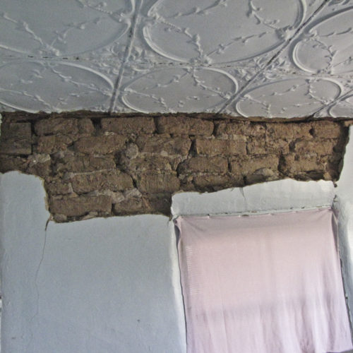
Hazards
July 10, 2009
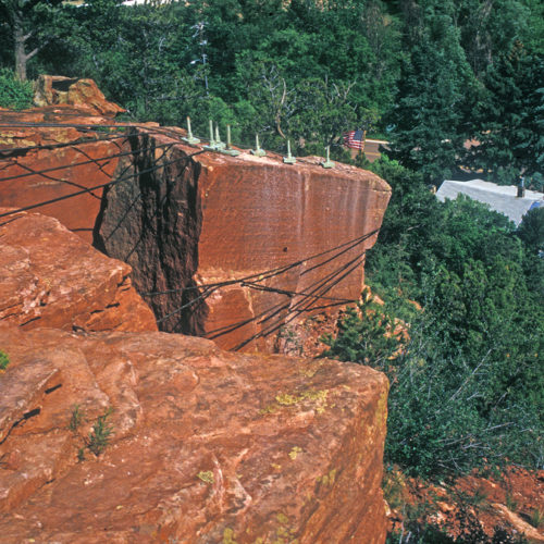
The CGS studied the site of St. Francis of Assisi Church in Castle Rock extensively after a block detached from…
General
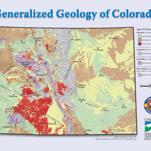
February 28, 2008
We have a free 8.5- x 11-inch (pdf) geologic map of Colorado containing Geo-Whizology of Colorado…
Hazards
July 6, 2005
The town of Glenwood Springs in west-central Colorado lies at the confluence of the Roaring Fork and Colorado rivers.
Hazards
June 21, 2005
Rockfalls and rock slides are common along transportation corridors in the Rocky Mountains. Clear Creek Canyon just west of Golden…
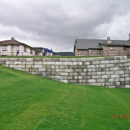
Hazards
April 26, 2005
For decades, the west side of the Colorado School of Mines (CSM) main campus had subsidence issues related to…
General
March 4, 2005
Dr. Cílek, the Director of the Czech Republic’s Academy of Sciences Institute of Geology delivers a…
Hazards
January 17, 2005
[ED: This report from January 17, 2005 was written by Jon White, (Senior Engineering Geologist, Emeritus). Lightly edited for dated…
Hazards
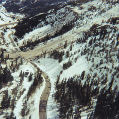
March 23, 2003
On March 23, 2003, a large avalanche occurred about one mile west of the Town of Silver Plume. The avalanche brought trees, rock, soil and snow to the valley floor, knocked down overhead utility lines, blocked the I-70 frontage road, damaged the town’s water treatment plant (WTP), and dammed Clear Creek. The dam was breached using explosives before the plant’s electric pump motors were flooded. With damage to the WTP’s chlorine contact tank and building, Silver Plume residents had to boil their tap water for over a month.
Geology
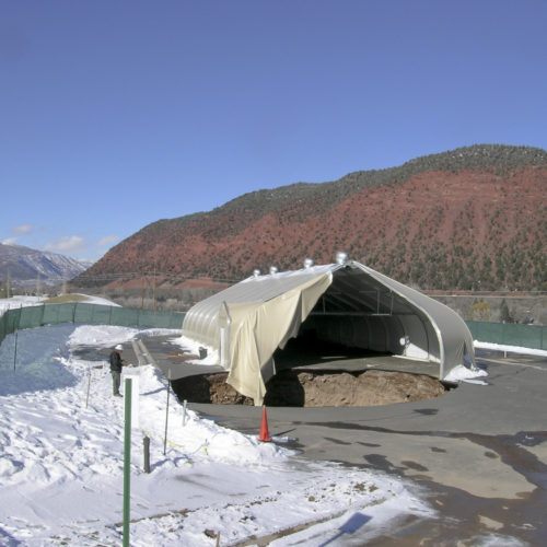
February 4, 2003
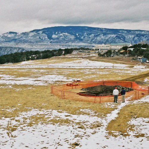
In early February of 2003, a 24-foot-wide (7.5 m) sinkhole spontaneously opened on a soccer field at the Colorado Mountain…
Hazards
September 26, 2001
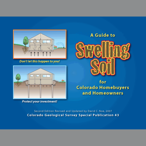
CGS Special Publication 43, SP-43 A Guide to Swelling Soils for Colorado Homebuyers and Homeowners, by…
Geology
October 1, 2000
In the next months, we will be sharing some unpublished field trip guides that we have made over the…
Hazards
June 19, 1995
[ED: This report from 1995 was written by Jon White, (Senior Engineering Geologist, Emeritus). It looks at a specific rockfall situation in the central Front Range town. ] Manitou Springs occupies a narrow valley where Fountain Creek emerges from the foothills northeast of Pikes Peak and west of Colorado Springs. The valley slopes are composed of interbedded resistant sandstone and conglomerates (i.e., gravelly sandstone), and weaker mudstones and shale. The outcropping sandstone is most prevalent on the steeper slopes on the north side of the valley.
Geology
August 9, 1967
Major magnitude 5.3 earthquake shock in Denver One of the strongest and most economically damaging earthquakes to affect the…
General
March 11, 1909
While a number of brilliant men have in past years held the office of Colorado State Geologist, it is no…
General
March 28, 1907
Regarding the Colorado Geological Survey (an article appearing in the Mining Reporter, March 1907): We note that one of our…
Geology
November 7, 1882
It has been 140 years since “The Big One”: Colorado’s largest historic earthquake: November 7, 1882 – Magnitude 6.6. On…