Description
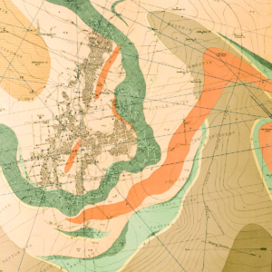
Describes and discusses the background of study, delineation, and evaluation of ongoing surficial-geologic processes that may present threats to people, structures, and infrastructure in Georgetown, Clear Creek County. Includes a summary of town history, geologic conditions, and references. 7 pages. 1 plate. Digital PDF download. OF-99-13D
Georgetown is located in a nearly north-south trending part of the valley of Clear Creek north and south of the confluence of Clear Creek and South Clear Creek in western Clear Creek County, Colorado. The Colorado Geological Survey (CGS) was asked by the Georgetown Planning Commission to study and evaluate geologic hazards in the town. This request was prompted, in part, by the town’s ongoing development pressure. There are numerous remaining legacies of Georgetown’s silver and gold mining era. These include mine shafts, mine dumps, tailings, some ruins of surface equipment and buildings, and over 200 historic buildings built during that time. Most of the slopes are very steep, and some barren rock cliffs are nearly vertical. All of the predominantly high-grade metamorphic bedrock in the area is heavily jointed and fractured. The lower side slopes immediately above the valley floor are underlain by coalescing debris fans and, on the east side of the valley, these areas are under the most pressure for development. Regrading of the topography from development shows that mine dumps and tailings have been used extensively as fill material. Rock fall and debris flows represent two on-going hazards.
