March 20, 1877
HM-01A Six 1877 Geologic Map Sheets and Two Cross Sections of Colorado (Hayden)
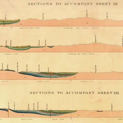
All six Hayden 1877 geologic map sheets of Colorado along with two sheets of 18 geologic cross sections to accompany…
March 20, 1877
All six Hayden 1877 geologic map sheets of Colorado along with two sheets of 18 geologic cross sections to accompany…
March 20, 1877
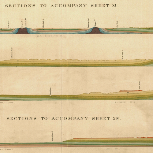
High-resolution scan of the 1877 geological cross sections of the Western Slope and Central Colorado excerpted from Hayden’s Geological and…
March 20, 1877
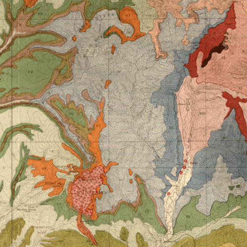
Hayden 1877 Geologic Map of Colorado, ~1:760,320. High-resolution scan of the original (Sheet IV of “Geological and Geographical Atlas of…
March 20, 1877
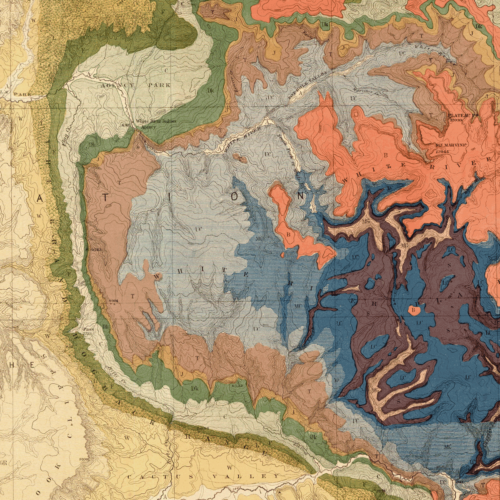
High-resolution scan of the 1877 geological map of Western Colorado and Part of Utah excerpted from Hayden’s Geological and Geographical…
March 20, 1877
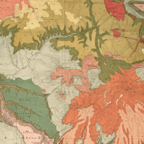
High-resolution scan of the 1877 geological map of North-Western Colorado and Part of Utah excerpted from Hayden’s Geological and Geographical…
March 20, 1877
High-resolution scan of the 1877 geological cross sections of the Front Range and Central Colorado excerpted from Hayden’s Geological and…
January 20, 1877
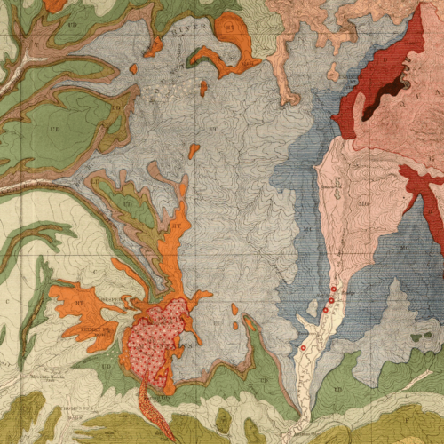
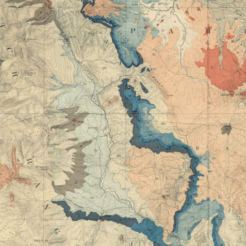
High-resolution scan of the 1877 geological map of Central Colorado excerpted from Hayden’s Geological and Geographical Atlas of Colorado and…

January 20, 1877
High-resolution scan of the 1877 geological map of North Central Colorado excerpted from Hayden’s Geological and Geographical Atlas of Colorado…
January 20, 1877
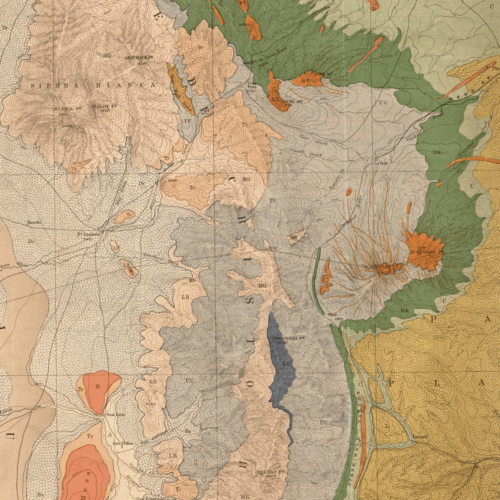
High-resolution scan of the 1877 geological map of Southern Central Colorado and Part of New Mexico excerpted from Hayden’s Geological…
January 20, 1877
High-resolution scan of the 1877 geological map of SW. Colorado and Parts of New Mexico, Arizona and Utah excerpted from…
Geology
October 11, 2019
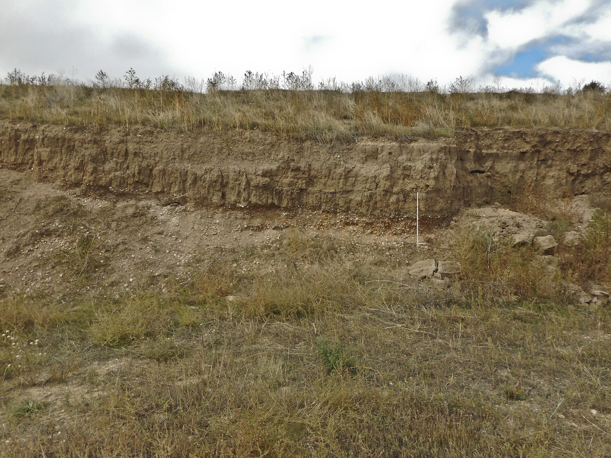
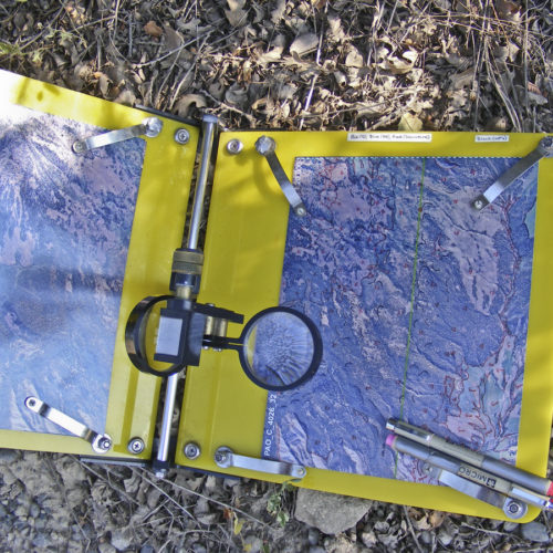
Geologic Mapping Intro GIS LiDAR Publications Links / Resources Geologic mapping involves plotting the location and attitude of the various…