Description
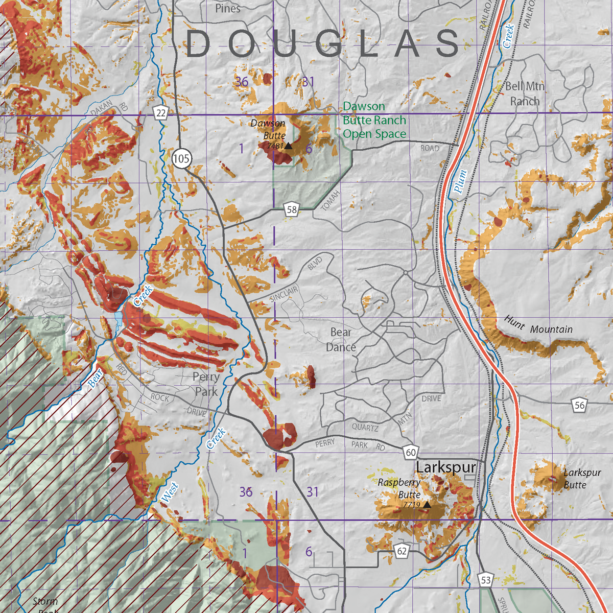
The CGS develops and provides geologic hazard susceptibility maps to state and local governments for use in planning processes and hazard mitigation plans. This map is part of a statewide effort to develop landslide inventory and susceptibility maps for landslide-prone areas in Colorado. Douglas County is the seventh most populous county in Colorado with the town of Castle Rock being the main population area that is quickly becoming an extension of the Denver Metro Area. This study 1) evaluates and maps known and previously unmapped landslide deposits with the aid of new high-resolution light detection and ranging (lidar) data and 2) identifies landslide-susceptible zones based on slope derived from a 10-m DEM and geology from geologic maps at various scales. Includes a report, a PDF map file, and GIS data. Digital ZIP download. OF-18-07D
From the Report:
A landslide is the failure and downslope movement of soil or rock due to the force of gravity exceeding the internal strength of the material. A distinct failure or rupture surface commonly forms below the failed mass on the surface where the weaker material moves downslope relative to the stronger, underlying material. Landslides may occur suddenly and move rapidly or slowly. All landslides have the potential to cause significant damage to structures. The type of material (for example rock, soil, or a mix) and failure movement mechanism (for example slide, flow, and fall) that provides nomenclature for the type of landslide. In this study, rockfalls, debris flows, and very slow-moving slumps and soil creep were not mapped.
…
Slopes on the flanks of buttes and mesas comprise the prominent topographic relief east of the Front Range in Douglas County. These landforms are capped by steam-channel deposits that have undergone topographic inversion leaving the former riverbeds now high in the landscape. Many of the buttes and mesas are underlain by sandstones and mudstones of the Dawson Formation and overlain by the gravel-rich beds of Castle Rock Conglomerate and Larkspur Conglomerate. Some are underlain by the volcanic Wall Mountain Tuff. Typically, the Dawson Formation is weakly cemented, highly erodible, and prone to the development of debris flows on the perimeters of the buttes and mesas. However, very few landslides have been previously mapped in these areas.
