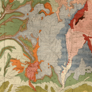
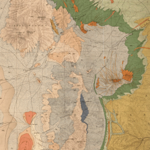
Description
Map shows basement structure in Colorado, including structure contours on top of Precambrian basement rock, selected wells drilled to Precambrian and Lower Paleozoic rocks, sedimentary basins, major oil and gas fields, Precambrian and Upper Cretaceous to Tertiary volcanic and intrusive rock outcrops. Major sedimentary basins and arches, as well as Precambrian mountain ranges and volcanic fields, are shown and labelled on the map. Also shown and listed are 73 gas fields and 129 oil fields ranked numerically according to cumulative production (most to least). Production values were as of December 1994. The digitization of this map was funded by a U.S. Geological Survey National Geological and Geophysical Data Preservation Program (NGGDPP) grant with matching funds provided by the CGS in the summer of 2020. 1 color plate (1:1,000,000). Digital ZIP/GIS/PDF download. MS-30D