Description
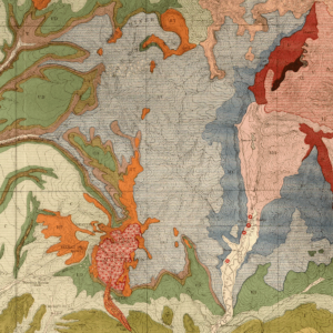
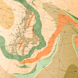
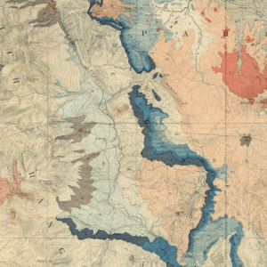
Cross sections showing stratigraphic framework of Upper Cretaceous Dakota sandstone, Mancos shale, Mesaverde Group, and Mesaverde Formation, and Lower Tertiary Wasatch Formation, West-Central Piceance Basin, Garfield County, Colorado. 2 plates. Digital PDF download. MI-32D
This product was prepared cooperatively with the USGS. Their publication number is Map MF-2008-A. The geologic cross sections are built from petroleum industry geophysical well-logs having depths ranging from about 4,000 feet to almost 9,300 feet. They trend in a roughly east-west direction. Included on Plate 1 is a chart showing nomenclature used by various authors for upper Cretaceous and Lower Tertiary rocks in and adjacent to the study area, as well as the key maps.